These recently opened trails in the Raleigh and Durham areas offer natural escapes, short and long distances, and varied terrain.
by Joe Miller
Over the decades, the appearance of a new hiking trail has long been a rare event. Maybe a short connector here, a brief reroute there. But a truly substantial, destination-worthy trail? Not so much.
But when the pandemic hit, interest in hiking surged — as did the money to invest in new places to do it. Since then, North Carolina trail projects have popped up like mushrooms after a spring rain.
The G5 Trail Collective, a nonprofit based in Old Fort, has opened the first 9 miles of a planned 42-mile network in the Pisgah National Forest; the Fonta Flora State Trail (which will one day link Morganton with Asheville) now has 30 of an estimated 100 miles complete; and Conserving Carolina continues to expand the Hickory Nut Gorge State Trail near Lake Lure, with 38 of 100 planned miles now open.
In 2021, the North Carolina General Assembly proclaimed 2023 the Year of the Trail, legislation that included $29.25 million for the Complete the Trail Fund. This past fall, legislators followed that up with nearly $55 million in funding as part of the Great Trails State Program.
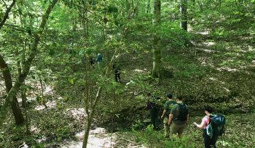
This wave of trail construction has benefited the Triangle substantially. Since the pandemic, we’ve seen everything from a long-awaited addition to the Raleigh Greenway system to the launch of a 16-mile trail network in a little-known mountain range in Alamance County. Whether you’ve kept up the hiking habit since 2020 or you need a reason to start again, the cusp of spring is a great time to explore. Here are five trails to try.
Panther Branch Natural Area; 2+ miles of trail
Devoid of boot-grabbing roots, rocks and other obstacles, the Eno River Association’s Panther Branch Natural Area, which opened in April 2023, is the perfect Piedmont hike. A few minutes down the trail and your mind begins to wander, opening the way for thoughts suppressed by the day-to-day grind. As the preserve’s two well-marked trails make their way through this 56-acre tract of young hardwoods in Orange County, the subtle beauty calms rather than distracts.
Which isn’t to say there’s nothing to look at. A short way in the tract follows a ridge above the Eno River; at the turn-around point the trail traces an oxbow on a particularly rocky stretch of the Eno. Here, a picnic table invites a rest to savor the setting. There are two intersecting trails: to see most of the preserve, take the Red Trail to the right; when it meets the Yellow Trail at Panther Branch, cross the creek and hike the trail counterclockwise. Possible weed-out: there’s a rock-hop crossing of Panther Branch, which could be tricky after (or during!) a good rain. When you return to Panther Branch, go right on the Red Trail to complete the double loop.
2437 Lebanon Road, Efland; visit enoriver.org for more info
Crabtree Creek West; 1 mile
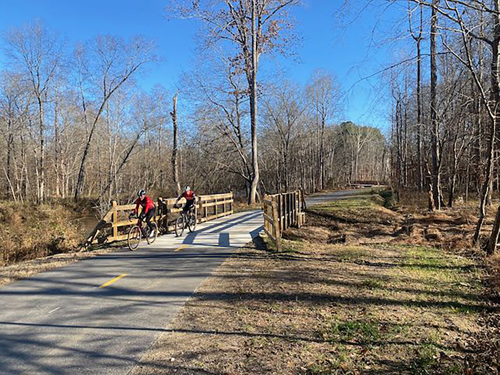
One of the few bright spots to emerge from the 2008 financial collapse was the $800 billion federal stimulus package, which included construction funding for “shovel-ready” projects. That money made possible the near-completion of the bulk of the Raleigh Greenway system. “Near,” because the exact path of the Crabtree Creek Greenway linking the Neuse River Trail with William B. Umstead State Park still hadn’t been determined. And while that entire remaining 2-mile stretch, from Lindsay Drive to Umstead State Park, won’t be finished until summer, the 1-mile trek from Umstead to Duraleigh Road opened this past October. The wait was well worth it. Starting from the ample parking lot off Ebenezer Church Road at Crabtree Creek and hik- ing downstream, the trail begins in a flood plain along Crabtree. Shortly, it diverts along Richland Creek before ascending a steep hill via an impressive switchback that includes an elevated boardwalk. The woods here are surprisingly mature, and the terrain is similar to what you find in Umstead, only on a paved surface that’s more accommodating to mobility-challenged walkers. This mile-long stroll offers perhaps the most rewarding experience on the Raleigh Greenway system.
Ebenezer Church Road between Clyden Cove and Poyner Road; visit raleighnc.gov for more info
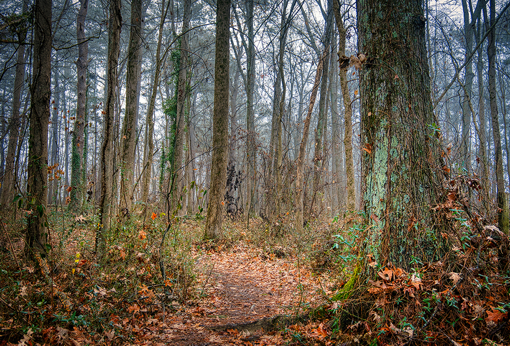
Cane Creek Natural Mountain Area; 10.4 miles of trail
For years, the Cane Creek Mountains of Alamance County were privately owned and shrouded in mystery. With peaks reaching nearly 1,000 feet, the relict chain promised a mountain-like experience tantalizingly close to the Triangle. Its shroud of mystery was lifted at the best possible time, at the start of the pandemic, when Alamance Parks opened the first 4.5 miles of trail, including a challenging climb up 987-foot Cane Creek Mountain (though hiking initially was by appointment only). Last fall, another 5.9 miles of trail opened. This addition includes two trails — the Longleaf and Heartleaf Loops — that quickly take you into a hardwood forest with long climbs reminiscent of the Southern Appalachians. The trail here is both rustic and expertly engineered, with local materials used for rock steps and erosion control. And plans call for a re- mote observation tower, possibly by year’s end, and another 15 miles of trail, for an expected buildout of 25 miles on 1,000 acres.
5545 Bass Mountain Road, Snow Camp; visit alamance-nc.com for more info
Mountains-to-Sea Trail at Falls Lake, Day-Hike Section P; 4.9 miles of trail (2.1 of which are new)
A new trail on the MST along Falls Lake may come as a head-scratcher to longtime followers of the statewide initiative, since this stretch includes some of the oldest trails in the system, dating back to the early 1990s. But several years ago, the stretch between Cheek Road and the Hickory Hill Boat Ramp in Durham County suffered a disruption when a bridge on a brief road section on Redwood Road washed out. The Friends of the Mountains-to-Sea Trail, which oversees the trail, saw the disruption as an opportunity to eliminate the road stretch with a 2.5-mile ramble down and back up Panther Creek, which opened in 2022.
The first mile along the creek follows an old railroad grade, crossing a low tres- tle or two; the return mile climbs a mellow hill and encounters signs of the pre-Falls Lake past. The new and improved Day-Hike Section P, from Hickory Hill to Cheek Road, now runs 5.9 miles.
Hickory Hill Boat Ramp off Redwood Road, Durham; visit mountainstoseatrail.org for a map and more info
Lily Loop, Bailey and Sarah Williamson Nature Preserve; 2.2 miles of new trail
Somehow, the Triangle Land Conser- vancy keeps squeaking out additional trails at its Williamson Nature Preserve in southeast Raleigh. The latest addition is the 2.2-mile Lily Loop, which brought to 16 the total miles of trail at the pre- serve in August 2022.
The Lily Loop, like most of the trail at Williamson, is open to mountain biking; thus, the trail tends to have lots of turns and doubles back on itself. Don’t be surprised to see other hikers (and cyclists) nearby. One advantage to this stretch is that it’s at the far end of the preserve, well away from the main trailhead. Thus, distance hikers will be rewarded with fewer trail companions when they reach the Lily Loop. The hiking is relatively flat, and includes access to the Neuse River Trail/Mountains-to-Sea Trail along the Neuse River.
4409 Mial Plantation Road, Raleigh; visit triangleland.org for more info

This article originally appeared in the March 2024 issue of WALTER magazine