These trails, each a short drive from Raleigh, showcase former mill towns, industrial works, farms, and estates from as far back as the 1700s.
by Joe Miller
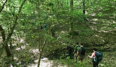
You’re hiking a new trail and you begin noticing subtle curiosities: a depression maybe 4 feet deep, 8 feet long; a stand of brilliant yellow daffodils amid the brown of late winter; a pyramid of stones, seemingly gathered intentionally — but why? The sylvan oasis you’re wandering today was likely once a thriving community. That depression? A root cellar, where food was kept cool. Those daffodils helped brighten a homestead, a sign that spring was nigh. And those rocks were painstakingly gathered by a family decades ago, as a new field was being cleared. History is everywhere along North Carolina’s trails; you just need to know what to look for. Here are six nearby trails that invite a deeper dive into what our area was like as far back as the 1700s.
Great Bend Park: Haw River Trail, Glencoe
For more than a century, the Haw River was the backbone of North Carolina’s textile industry, at one time supporting dozens of mills that used its water to power their operations and take away their waste. You’ll find two of these old mills along a mile-long stretch of the Haw River Trail (aka the Mountains-to-Sea Trail) at Glencoe. From Great Bend Park, pick up the trail and take a moment to scout the Haw from atop an old lock that once helped funnel water to the Glencoe Mill. Continue hiking downstream into Glencoe, where you’ll pass buildings that once housed the mill and are now in the process of a resurgence with new businesses moving into the revitalized structures. The trail buddies up to the Haw at the Glencoe Paddle Access, paralleling a millrace (a channel for water that would power the mill) for three-quarters of a mile before depositing you at the Carolina Mill. While many old mills are finding new life as offices, retail outlets, and residences, the Carolina Mill, with its broken windows and vacant interior, is a ghostly reminder of its past. Time your visit right and you can learn all about the area’s textile history at the nearby Textile Heritage Museum.
Start at 350 Greenwood Drive, Burlington; 3.6 miles out-and-back; for hours and more info, visit thehaw.org
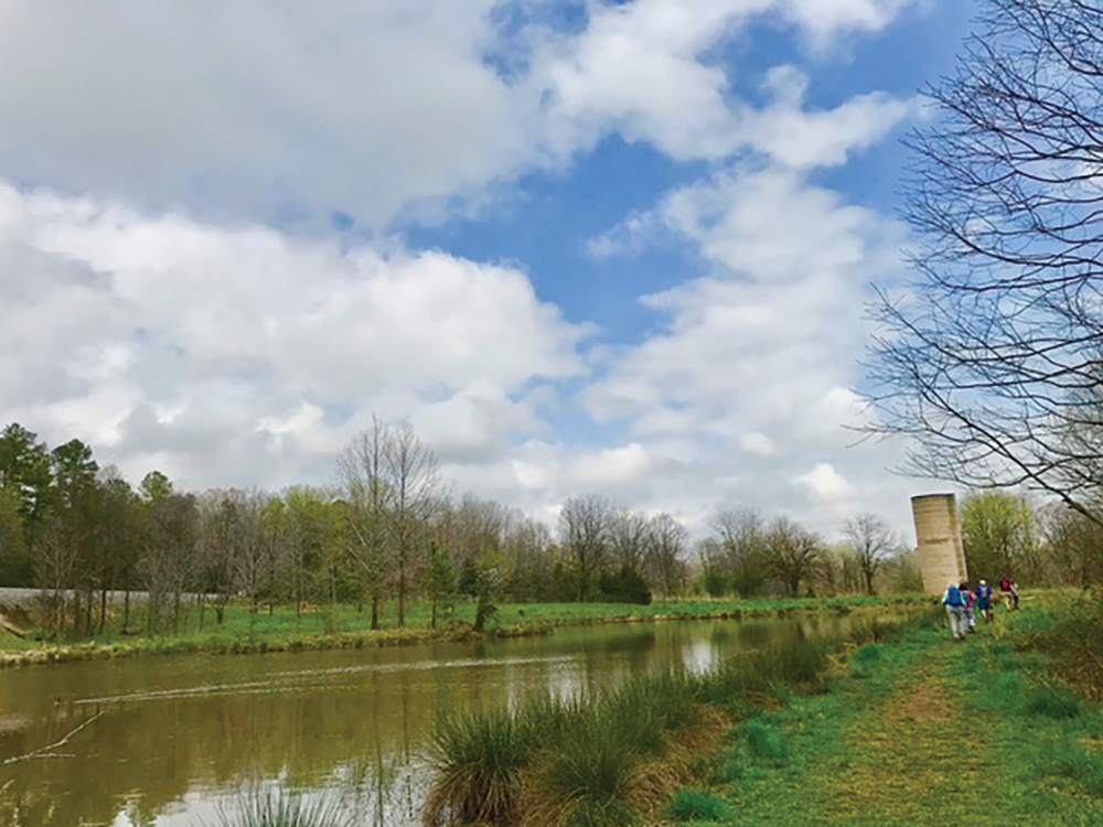
George and Julia Brumley Family Nature Preserve: Cemetery Connector; Stony Creek Bluff, and Dairy Farm Trails, Chapel Hill
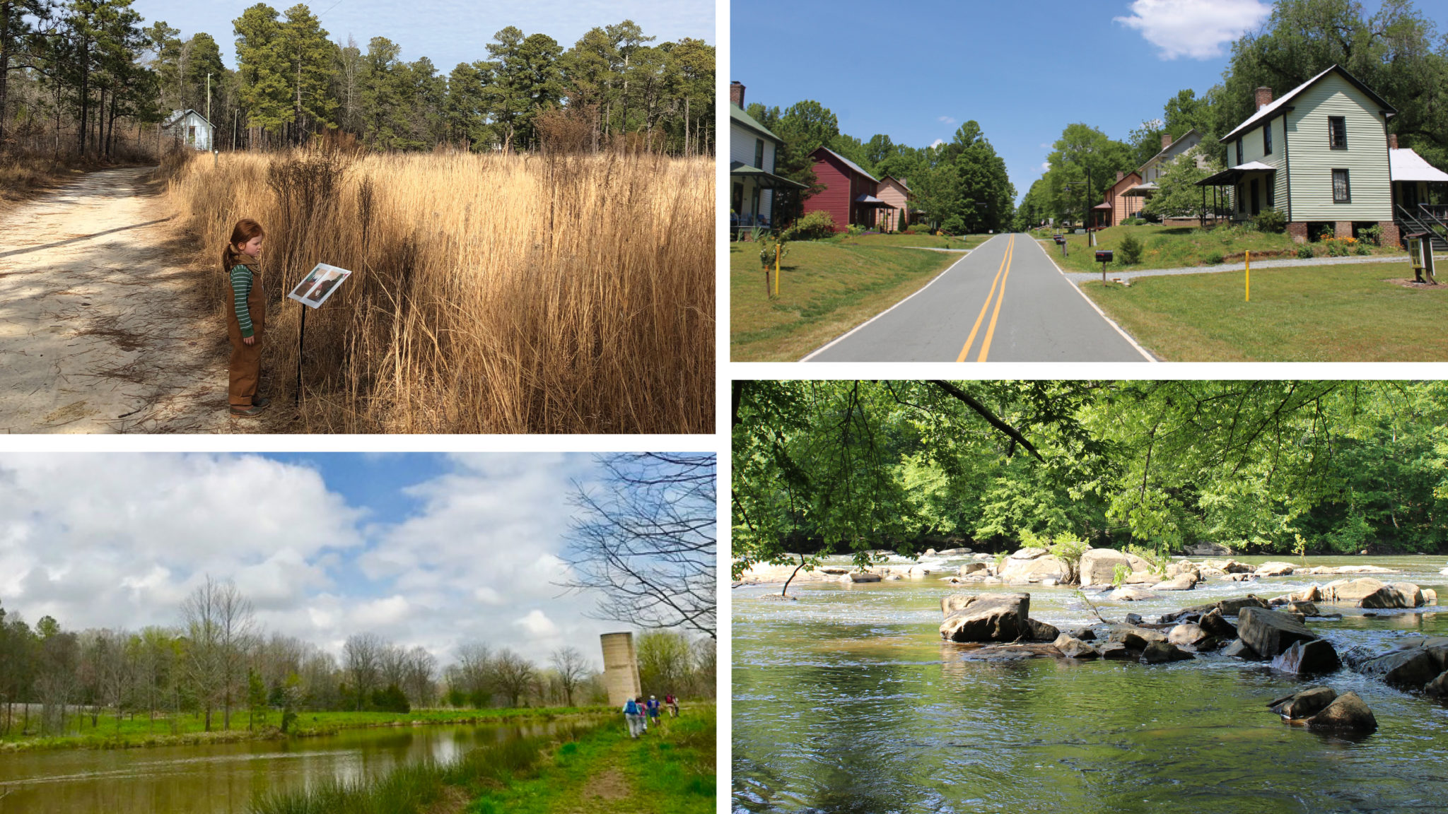
Many Piedmont trails are on long-abandoned farmland, where trees have resumed their rightful places and signs of an agricultural past are becoming harder to find. A giant white oak amid smaller trees likely signifying a homestead, the remains of a stone foundation, ripples in the land where tobacco once grew — these subtle signs are apparent only to those who’ve studied such things. Then you have Brumley North, where just a few steps in you find an ancient cemetery, a sure sign of human habitation. Take the Cemetery Connector Trail to the Stony Creek Bluff Trail, go left, cross its namesake creek, and you’ll come to one of three farm ponds on the northern portion of the preserve. The Dairy Farm Trail takes you to a second pond and an impressive grain silo and livestock shed, both of which date back to the early 1900s, when they were part of the Strayhorn family farm (which was previously part of the Bennehan-Cameron Plantation). Before that, the land was home to the Eno, Lumbee, and Shakori people.
Start at 3620 Old State Highway 10, Chapel Hill; 1.4 miles (as described); for hours and more info, visit triangleland.org

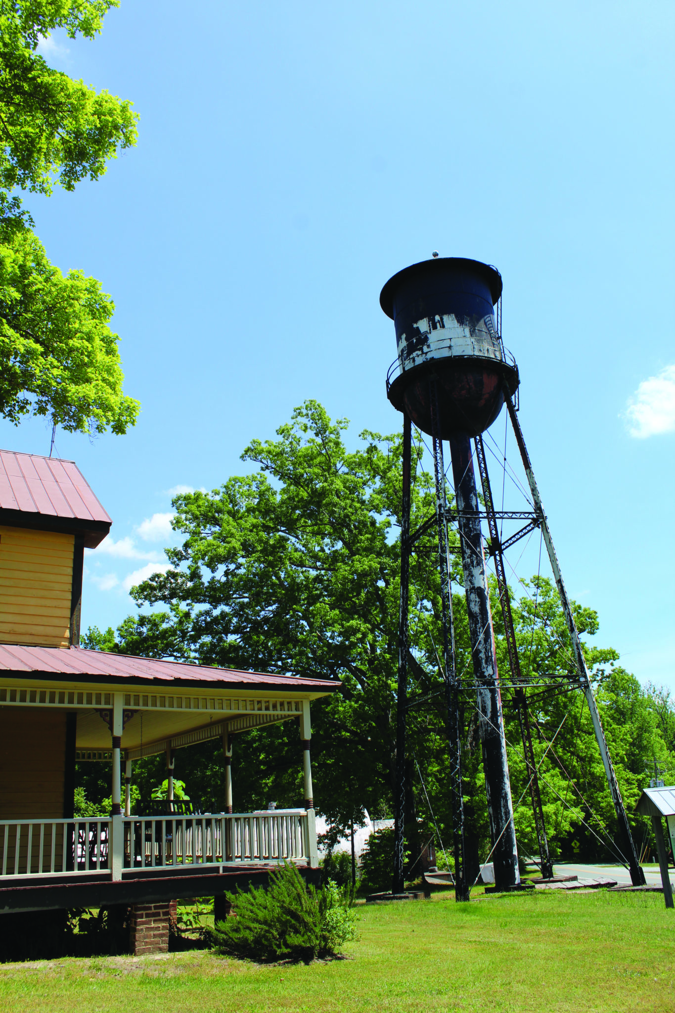
Umstead State Park: Company Mill Trail, Raleigh
This is one where not-so-old-timers can adopt an authoritative voice and say, “I remember when the dam went all the way across Crabtree Creek. In fact, we used to walk across the top.” Which is true — and even more adventurous than it sounds. Time was (still in the old-timer’s voice), this was not only a mill where farmers brought their grain to be ground, but the social hotspot of the region. Dances and other events were held at the mill, which was, in the 1800s, an outpost from distant downtown Raleigh — by horse and wagon standards. Built in 1810 and originally called the Page Mill, the mill flourished for about a century. But the Page family eventually moved, and the surrounding farmland, which had been worked to depletion, was purchased by the Federal government and eventually became Umstead State Park. The dam, which harnessed Crabtree Creek, remained pretty much intact, and was the main way to cross Crabtree (about a mile down the trail), until Hurricane Fran in 1996, when floodwaters overcame the structure. Today, you can still see remains of the dam wall on the south bank of Crabtree, as well as a millstone just off the trail on the north bank. To learn more of its history, check out Stories in Stone by Tom Weber.
Start at 2100 N. Harrison Ave., Cary; 2 miles out-and-back; for hours and more info, visit ncparks.gov
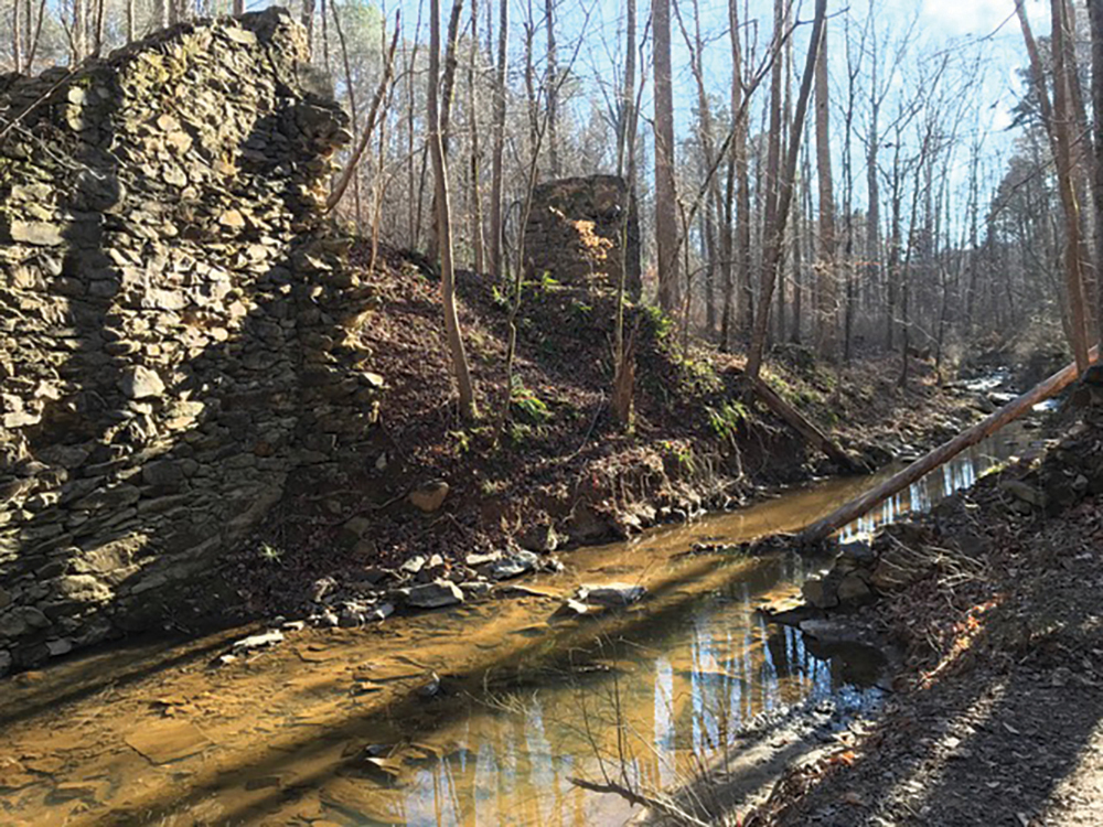
Eno River State Park: Pump Station Trail, Durham
Hiked in winter, you get a sense that something’s coming shortly after heading down the trail: about 30 yards to your left, a 3-foot-high rock wall starts paralleling the trail. That wall quickly leads to a sizable dam, now breached, that once impounded six million gallons of water on Nancy Rhodes Creek. Keep an eye on the creek below the dam and within a hundred yards or so lie the remains of the pump station that once supplied water to Durham. The foundation of the pump station remains largely intact in the form of exposed brick walls rising 10 to 15 feet, providing an outline of the facility that opened in the 1880s. Less easy to spot is the 100-foot-long dam that once blocked the Eno, just below Nancy Rhodes Creek. Watch the kids: enough of the Pump Station’s skeleton remains that young ones will be tempted to try to figure out how the operation worked.
Start at 4023 Rivermont Road, Durham; 0.6 miles out-and-back; for hours and more info, visit enoriver.org
Horton Grove Nature Preserve: Sowell and Jordan Trails, Bahama
Today, the 708-acre Horton Grove Nature Preserve is the largest public preserve in the Triangle Land Conservancy’s portfolio. In a past life, it was part of the 30,000-acre Bennehan-Cameron plantation, once home to more than 900 enslaved people. The preserve’s past is reflected in its eight trails, each named for a Black person or family who lived on the plantation. From the trailhead at the Great Barn on the preserve’s south end, the Sowell Trail explores an old farm pond as well as tobacco fields, long-since given over to pines and hardwoods. It honors Amy Sowell, who was born on the plantation in the 1850s and served as a midwife and community leader for most of her nearly 100 years. If a mile isn’t enough, pick up the Jordan Trail behind the Great Barn. Named for Abner Jordan, who shared his story of life on a plantation with the Works Progress Administration in the 1930s, the trail begins in a pine stand and winds up in a rolling hardwood forest after three-quarters of a mile. Here, either return the way you came, or, if the spirit (and your legs) are willing, take the Walker Trail to link with five other trails. Leave time to explore the original slave dwellings near the Great Barn, as well as nearby Historic Stagville, a historic site detailing the areas past. Visit historicsites.nc.gov to learn more about the history of the area and the people for whom the paths are named.
Start at 7360 Jock Road, Bahama (park opposite the Great Barn on Jock Road); 1 mile, with options for more; for hours and more info, visit triangleland.org.
Carvers Creek State Park: Rockefeller Loop Spring Lake
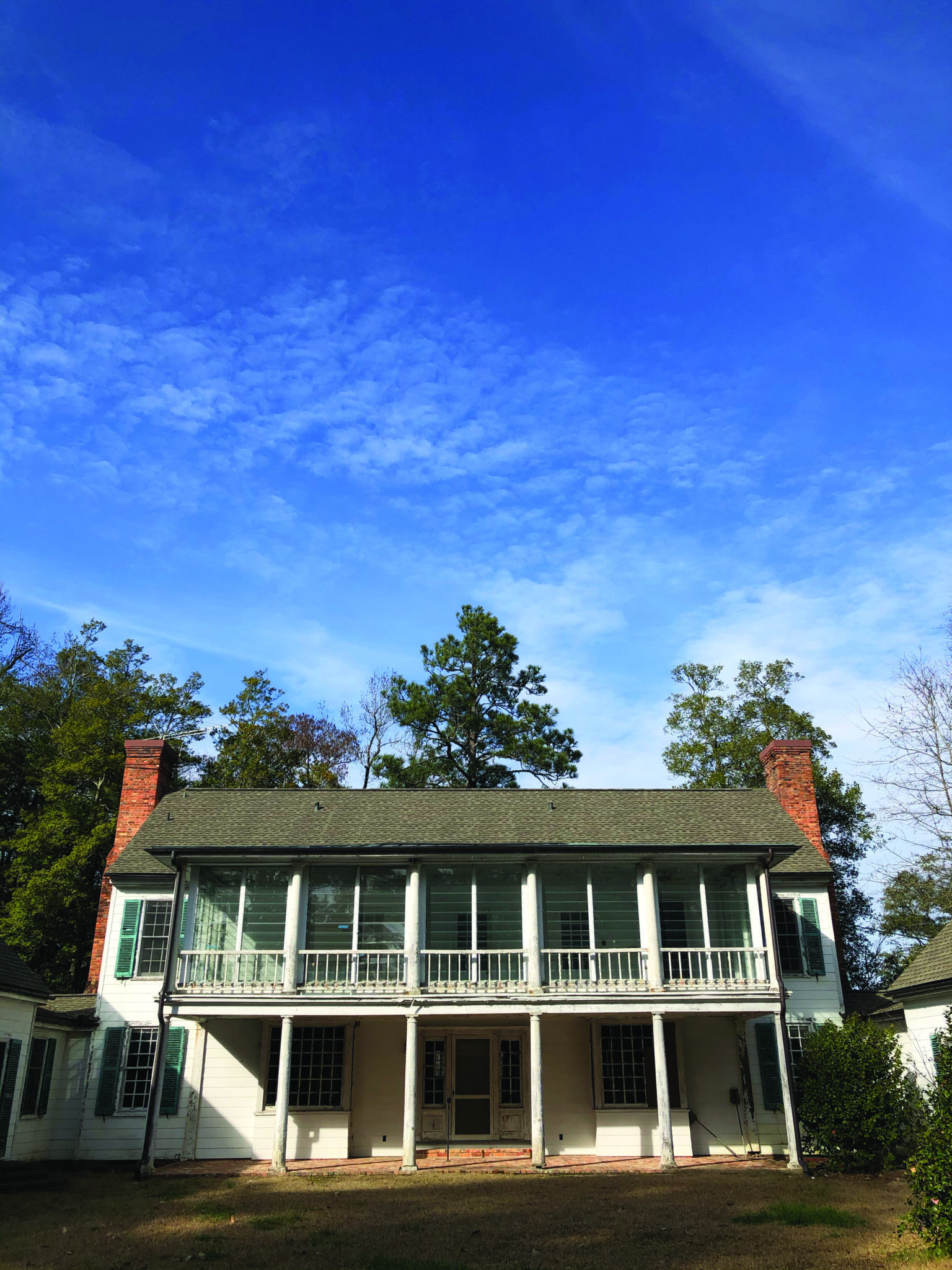
When you think of Wall Street financiers getting away for the weekend, you think of them heading off to New York’s Hamptons, maybe the Berkshires — not the Sandhills of North Carolina. Yet in the middle of the 20th century, that’s where banker James Stillman Rockefeller, of the Standard Oil Rockefellers, elected to retreat: to the 1,400-acre spread he called Long Valley Farm. Rockefeller relaxed by working on the farm and swimming in the millpond behind the family’s comparatively modest (just 6,000 square feet) farmhouse. It’s easy to understand Rockefeller’s affinity for the area along the 2-mile trail that bears his name. From the park office, the trail explores a longleaf pine forest and a farm field as it makes its way to the house, millpond, and outbuildings, which are in the process of being restored. (With plans to eventually be turned into a multi-use educational and community center.) Tack on the three-quarter-mile Cypress Point Loop Trail for an up-close view of the house and millpond, which supports a healthy grove of cypress trees. Rockefeller preferred to visit in cooler weather, for good reason: the Sandhills exposure makes for an enjoyable hike on a cold, sunny winter’s day.
Start at 2505 Long Valley Road, Spring Lake; 2 miles, with options for more; for hours and more info, visit ncparks.gov.
This article originally appeared in the November, 2021 issue of WALTER Magazine